 Galičica National Park (also know as Национален парк Галичица in Macedonian and Parku kombëtar Galicica in Albanian) is
a 227 km²
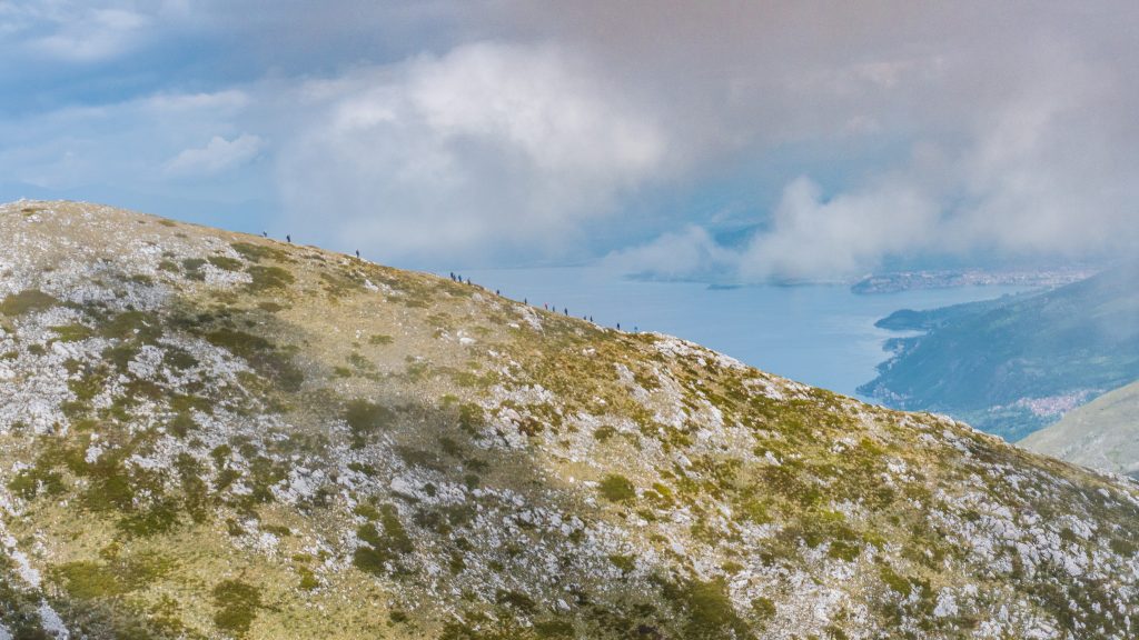
park located in the southwestern part of North Macedonia, close to the borders with Albania and between lakes Ohrid and Prespa. It has nice views of the lakes, a lot of nature, interesting beaches, churches and second-highest peak in the country, Magaro (2,255 m). Despite being so close to the border with Albania, most of the villages and towns in the part are inhabited mostly by ethnic Macedonians.
 How do I arrive to Galičica National Park?
This National Park is easy to be reached, being able to arrive mainly from Ohrid or from Albania too.
- Boat: there is a daily boat from Ohrid to St. Naum (aprox. 1.5 hours).
- Bus: there are 6-7 daily buses from Ohrid to St. Naum, stopping at other sightseeing points like Bay of Bones Museum.
- Car: from Ohrid it can be reached many places like Elšani and Peštani (aprox. 20 minutes), Trpejca (aprox. 30 minutes), Ljubaništa (aprox. 35 minutes), St. Naum (aprox. 40 minutes) and Stenje (aprox. 1 hour). It can also be reached from the Albanian side of the border like, for example, Pogradec or Korçë.
History
Galičica National Park was established in 1958 and later the legislation was changed to enforce a much stricter protection system. The park is the refuge of a large number of animal and plant species, sometimes very rare, such as the lynx, brown bear, wolf, etc. About 2/3 of the park is included in the boundaries of the World Natural and Cultural Heritage of the Ohrid region, inscribed on the UNESCO World Heritage and Natural Heritage List.
What can I visit in Galičica National Park?
Galičica National Park (80 MKD) is quite developed, mainly because of being so close to Ohrid. Many outdoors activities can be done here as well as discover its local nature (with 13 endems exclusively found here). Now it will be explained what to do in the park according to
the town or village where they are or the nearest one:
- Outside Ohrid it can be done Velgoshti-Ohrid Visitor Center trail (12.5 km), a medium difficulty trail that runs through low vegetation while in the upper parts through woodland.

Gorica beach - Very close to Ohrid it can be found Šipokno (Елшаниin Macedonian, Zhuzhnjë in Albanian), a 590 people village with relaxing vibes and great views of the lake. From here there are several routes to discover Galičica National Park by its trails. The visitor can enjoy a very beautiful beach, Gorica beach, and visit St. Stefan Pancir Macedonian Orthodox Church. It's a 14th century church built in a natural cave and with frescoes from those times (although in poor conditions). From here there are nice views too. Not far from here it can be enjoyed Dva Javora- Mountain House Sharbojca-Veslestovo trail (14.2 km), route that passes through the central part of the mountain and it can be stopped at Samotska Cave, the largest cave in the park.
- In the eastern part of the National Park, by lake Ohrid, it can be found Elšani (Елшаниin Macedonian, Zhuzhnjë in Albanian), a 590 people village with relaxing vibes and great views of the lake. From here there are several routes to discover Galičica National Park by its trails such as Elšani-Veslestovo trail (16.8 km), a beautifully trail that combines almost all types of habitats represented in Galičica National Park, or Elšani-Galičica Pass trail (13.3 km).

Bay of the Bones - Peštani (Пештани in Macedonian): 1,326 inhabitants town that has been transformed recently from a quiet fishing village to a tourist village.
- Peštani-Galičica Pass trail (8.2 km): interesting trail available to discover the heart of the National Park.
- In the way from Peštani to Trpejca there's Bay of Bones Museum (9-19 from Jul to Aug, 9-16 Tue-Sun from Sep to Jun; 100 MKD/ 30 MKD adults/ students and kids), reconstruction
of a Neolithic settlement (1,200-600 AC) that consisted in buildings
and fortifications atop the water, with
reconstructed pile-dwelling settlements with various objects inside to
help
illustrate what life was like at this spot many years ago (and probably
all over lake Ohrid). There's also a museum and the site also features a
scuba diving
center.

Route to Magaro Peak - Outside the museum it can be enjoyed a nice beach, Gradishte beach.
- The highest peak of the National Park, Magaro Peak, can be reached in the medium difficulty trail Galičica Pass-Magaro Peak (7.6 km). The route runs along the cliffs, making a loop around the cirques and along it can be seen some remnants of WW1.
- Trpejca (Трпејца in Macedonian): 303 inhabitants village by lake Ohrid, the only remaining traditional fishing village in the area. It's sometimes refered as the Macedonian version of Saint-Tropez.

Trpejca - St. Zaum Monastery (only accesible by boat): 13th century monastery placed in a stunning location, considered to be among Ohrid area's most significant churches. Its frescoes were completed in 1361 and they are impressing, just like its architecture.
- Trpejca beach: narrow beach with one of the cleanest waters on the lake.
- Ljubaništa (Љубаништа
in Macedonian, Lubanisht in Albanian): 171 people village in the southwestern part of Galičica National Park, known for being home of St. Naum Monastery.
- Ljubaništa beach: long, sandy with usually clean water beach. It's considered the best beach by lake Ohrid and its sunsets are unforgetable.
Just in the border with Albania it can be found St. Naum Monastery (7-20 from Jun to Aug; 7-sunset from Sep to May; 100 MKD), monastery founded in 910 (current outlooks dates back to the 16th century) that is an important pilgrimage place and is considered one of the most beautiful in North Macedonia. It was founded by St. Naum (medieval writer and enlightener, one of the seven Apostles of the First Bulgarian Empire and missionary among the Slavs, one of the disciples of Sts. Cyril and Methodius) and his grave is still here, being popular getting on your knees and try to listen the heart of St. Naum. Its frecoes were painted in 1806 and the icon screen was made in 1711 (oldest completely preserved wooden high icon screen in the country). It has breathtaking views over Ohrid Lake and Galičica mountains Around the monastery there is a pleasant sandy beach.
St. Naum Monastery 
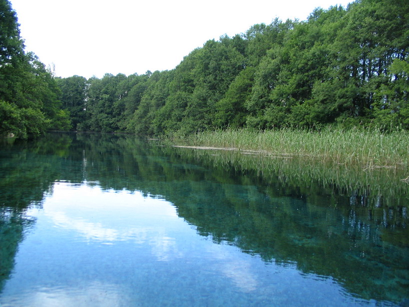
Black Drim Springs - Next to St. Naum Monastery it can be found some nice beaches like St. Naum beach. Here it's also located Black Drim Springs, place where the river begins, flowing through the entire lake to Struga, reaching Albania from Debar.
- On the other side of the park, by lake Prespa, it can be found Oteševo (Отешево in Macedonian), an uninhabited village by the lake. It's the starting point for Oteševo-Peek Goga-Mountain House Sharbojca trail (23.3 km), one of the most difficult trails in the National Park that passes through the east and central parts of the mountain, and it can also be seen the Monument to the Prespa Meeting of the Central Committee of the Communist Part of Macedonia, and
interesting communist memorial that
consists of several detached white arched walls pointing upwards.
Monument to the Prespa Meeting of СКМ - Not far from Oteševo you can go to the village of Stenje (Стење in Macedonian), with 438 inhabitants and close to the border with Albania. Here it can be climbed Stjensko Blato, a birdwatching tower, or enjoy Stenje beach.
- Golem Grad: 750m long and 450 m wide island located in the middle of lake Prespa that is home of important animals, especially snakes, turtles, birds like pelicans or cormorants as well as several ancient ruins and churches. It is also home to several different communities of animals, especially snakes. It was the summer resort of tsar Samuel of Bulgaria.
- St. Petar Macedonian Orthodox Church: 14th century church, in not very good conditions, with some remains of frescoes.

Golem Grad - Roman ruins: all over the island there are ruins of buildings from Roman times such as the remains of a Roman house or of an impressing tanker.
- There are other ruins of churches all over the island from early Christian periods (5th-6th centuries).
- The cruise to the island on its own is worthy because it can be seen how beautiful Golem Grad is and birdwatch pelicans.
- Visitors should be careful because there are many snakes in the island (some of them poisonous.
- St. Petar Macedonian Orthodox Church: 14th century church, in not very good conditions, with some remains of frescoes.


 08:19
08:19
 Banknotemaniac
 Posted in: