Showing posts with label Kosovo. Show all posts

Monday, 23 March 2020

Sharr Mountains National Park

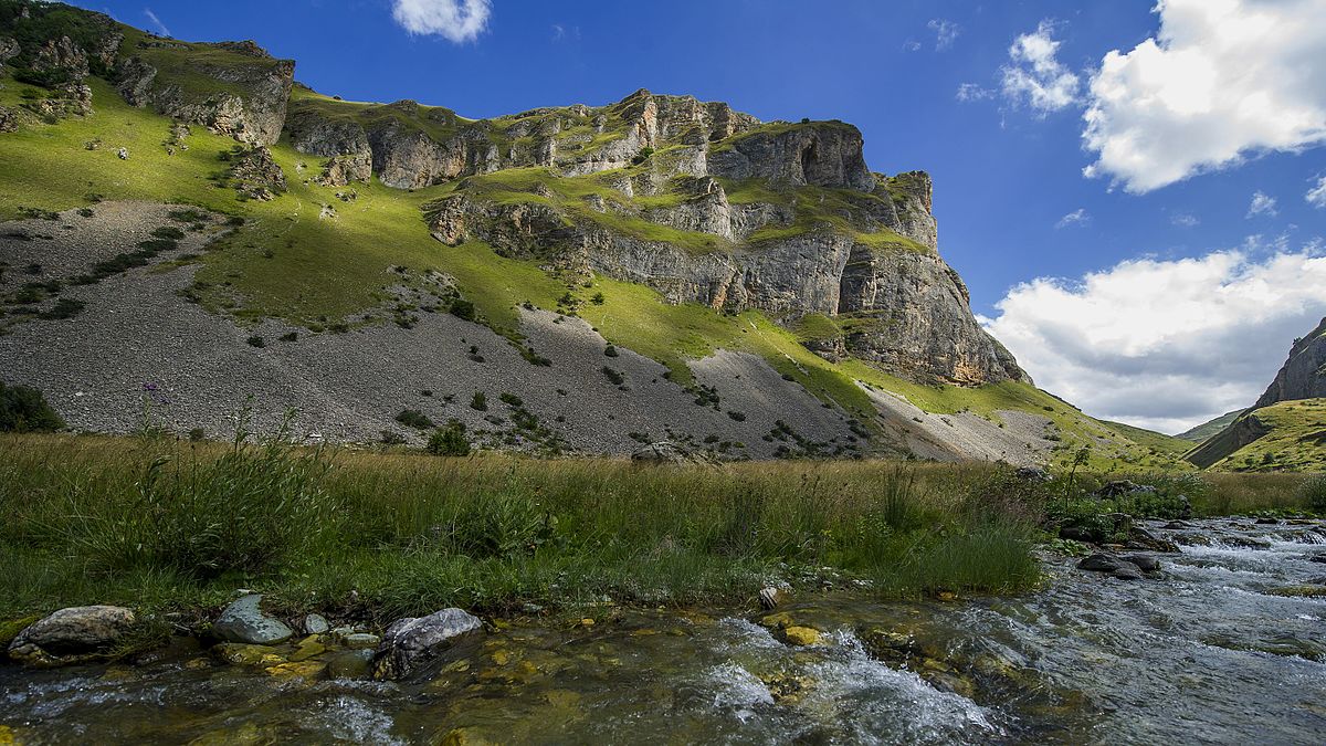
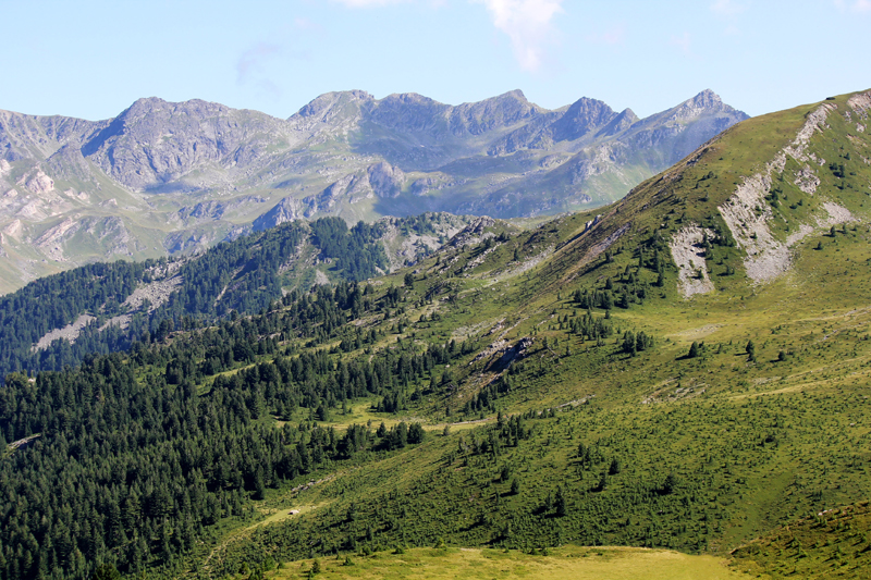
Sharr Mountains National Park (also know as Parku Kombëtar Malet e Sharrit in Albanian and Национални Парк Шар Планине in Serbian) is a 533 km² park located in the southern part of Kosovo, in the districts of Prizren and Ferizaj, in the border with North Macedonia. It's a very nice place to discover unspoilt mountains and skiing.


How do I arrive to Sharr Mountains National Park ?

 The area isn't too difficult to be reached, being able to arrive from Prizren and Pristina too.
  • Bus: there are minibuses from Prizren that connect it with many villages in Sharr Mountains. There are buses from Ferizaj to Gjilan (aprox. 30 minutes) too.
  • Car: from Prizren it can be reached Mušutište (aprox. 30 minutes), Prevalla (aprox. 40 minutes), Dragash (aprox. 45 minutes), Brod (aprox. 1 hour 10 minutes) and the rest of villages in the National Park and Prevalla can also be reached from Pristina (aprox. 1 hour 20 minutes). On the way from Pristina to Skopje (North Macedonia) you can also visit Ferizaj (aprox. 40 minutes) or Kaçanik (aprox. 45 minutes) (they are only 20 and 40 km south from Lipljan).
 Once in the Park the best ways to move around the park are the car, taxis or simply hiking.  

History

The route of an ancient road crossed the Scardus from 169 BC onwards and on the Roman period, the mountain was a tripoint between the provinces of Dalmatia, Moesia and Macedonia. It became later part of the Byzantine empire and then part of Serbia. When King Milutin donated lands to the Our Lady of Ljeviš church, he also donated the Višegrad Fort to serve as an Prizren's defence outpost. Emperor Dušan later expanded the fort to the river and built his endowment, the Monastery of the Holy Archangels (formerly in Mušutište). There are 45 Serbian Orthodox monasteries on the slopes of the mountain, dating from the 12th to the 16th century (and 32 monasteries were damaged or demolished during the NATO bombing of Serbia in 1999). The National Park was created in 1986 and expanded in 2012.
 

What can I visit in Sharr Mountains National Park ?

The visitor should be careful because in Sharr Mountains there are many Yugoslav shepard dogs (or Šarplaninac) that are very cute but may have rabies. These are many things to do in Sharr Mountains National Park such as trekking or skiing. Here they'll be explained now according to the town or village where they are or the nearest one:     
  • The east of the national park, close to the border with North Macedonia, there are interesting trails. One of them is Luboten Peak Trail (17.7 km round trip), a demanding trail that arrives to the top of Luboten Peak (2,498 m). This mountain in the border between Kosovo and North Macedonia, although not the highest, can be seen from both Pristina and Skopje.
  • Štrpce (Shtërpcë in Albanian, Штрпце in Serbian): 1,265 inhabitants small town in the district of Ferizaj that has a majority of Serbian population. Since 2013 Brussels Agreement the municipality will have to be included in the Community of Serb Municipalities.
    • St. Nikola Serbian Orthodox Church: church built in 1576 whose iconostasis is considered to be from the 19th century and the church's belfry was not built until 1912 (because of the Ottoman Empire).
    • St. Jovan Serbian Orthodox Church: church that was built in 1911 on the foundation of another unknown church. 
  • In the small town of Mušutište (Mushtishtë in Albanian, Мушутиште in Serbian), 3,394 inhabitants, in the northern part of the National Park there used to be an important Serbian minority and even 10 Serbian Orthodox churches; some of them were destroyed during Kosovo Wars such as the impressing 14th century Bogorodice Odigitrije Serbian Orthodox Church.
  • Prevalla (Prevallë in Albanian, Превалц in Serbian): nice touristic and ski resort located in the southern part of Sharr Mountains National Park.
    • Kobilica: 2,466 m high pyramid-shaped peak close to Prevalla, home to the biggest herds of chamois. The peak can be reached by taken Kobilica Route (23.6 km round trip).
    • Prevalla's Rock Peak: 1,991 m high mountain south from Prevalla. It's the starting point of the river Bistrica’s pass.
    • Brezovica Ski Resort: old Yugoslav ski resort that was a back-up for the Sarajevo Winter Olympics in 1984. It's the largest ski center in Kosovo. From here depart may trips to the mountains and one of them is Brezovica Ski Resort-Brezovica Lake Round Trail (13.8 km) towards Brezovica Lake.
    • Oshlak Peak Trail (15.9 km round trip): trail that arrives to Oshlak Peak (2,212 m).
    • Prevalla-Jazhincë Lake Trail (15.6 km round trip): nice trail that takes you to this small glacial lake with cold but crystal clear water, Jazhincë Lake.
  • The westernmost place in the National Park (and of Kosovo) is Dragash (Dragashi in Albanian, Драгаш in Serbian), a 1,098 inhabitants small town in the region of Gora, where Gorani people live. It's the center of the municipality with the same name and has some mosques such as Zlipotok Mosque in the village of Zlipatok.
  • Brod (Brod in Albanian, Брод in Serbian): picturesque 1,544 inhabitants town in the southwestern part of the National Park. Its main feature is the fact of being inhabited by Gorani, a Muslim Slavic ethnic group that has its own language (Gorani or Našinski, quite linked to Serbian, Macedonian and Bulgarian).
    • The town is interesting and different enough to make it worth a visit. Its graveyard is quite curious to be seen too.
    • Walking 3-4 hours south you can reach walking Rudoka Peak-Shutman Lakes Round Route (20.7 km), a hike with nice views by the river, an impressing canyon the highest peak in Kosovo, Velika Rudoka (2,658 m high), and the two Shutman Lakes.
  • There's a route called High Scardus Trail (495 km) that goes all over Sharr Mountains range visiting Albania, Kosovo, Montenegro and North Macedonia. The parts that take place in Kosovo are the following ones: Staro Selo in North Macedonia-Brezovica in Kosovo (24 km), Brezovica-Prevala (22 km), Prevala-Vejce in North Macedonia (24 km), Beshala in North Macedonia-Brod (21 km) and Brod-Torbeshki Most in North Macedonia (27 km).
Brezovica Ski Resort
Brod


St. Cara Uroša Serbian Orthodox Church and
Ferizaj Great Mosque
Outside the National Park, in the road between Pristina and Skopje there are some things to visit. One of the first ones can be Ferizaj (Ferizaji in Albanian, Урошевац in Serbian), a 42,628 people town with a great history of religious coexistence that is home of an US Army base (the most expensive built since Vietnam War). That tolerance can be seen in an Orthodox church and a mosque being wall to wall, unique in the world. St. Cara Uroša Serbian Orthodox Church (free) is a church built in 1933 and the other is Ferizaj Great Mosque, 19th century mosque built to commemorate Ottoman victory over Albanians during a Prizren League uprising. Continuing south you reach the town of Kaçanik (Kaçaniku in Albanian, Качаник in Serbian) with its 15,634 inhabitants, known because of Kaçanik Fortress, built by koca Sinan Pasha in the 16th century to keep out kachaks (Albanian bandits). Here you can also take a look at Sinan Pasha Mosque, a nice 16th century mosque built in the fortress construction's times; from here it can be visited Kaçanik Gorge, a nice gorge by river Lepenac.

Where can I eat in Sharr Mountains National Park?

This National Park is almost uninhabited so it's important to bring food from outside the park. Once in the National Park, mainly in the region of Gora, it can be nice to try the traditional cheese from here, Šar cheese.

Bjeshkët e Nemuna National Park

Bjeshkët e Nemuna National Park (also know as Parku Kombëtar Bjeshkët e Nemuna in Albanian and Национални парк Проклетије in Serbian) is a 630 km² park located in the western part of Kosovo, in the districts of Peć and Gjakova, in the border with Montenegro and Albania. Its most famous part is Rugova Canyon (not far from Peć) that has narrow roads across mountains, glacial lakes and deep woods where practising plenty of outdoor sports. Its mountains (that reach in Albania and in Montenegro) are considered one of the nicest in east Europe and are preserved in a very good way.
 

How do I arrive to Bjeshkët e Nemuna National Park ?

 The area isn't easy to reach, mostly arriving from Peć.
  • Bus: there are minibuses from Peć that connect it with all the villages in Rugova Canyon.
  • Car: from Peć it can be reached Radac (aprox. 15 minutes), Drelaj (aprox. 30 minutes) and the rest of villages in the National Park. You can reach Boga from Kuqishta (aprox. 15 minutes). It can also be reached from Prokletije National Park (aprox. 2 hours) in Montenegro and Valbona Valley National Park (aprox. 3 hours) in Albania.
 Once in the Park the best ways to move around the park are the car or taxis.  

History

The area was inhabited since the time when people lived in caves, proven by the discovery of a man's femur in Radaci Cave. The earliest official documents about Rugova are from the 13th century, being heavily populated two centuries later. After the invasion of the Balkans by the Ottoman Empire (1389), Rugova was part of the Sanjak of Scutari, from the 16th century part of the Sanjak of Dukagjin and after 19th century administrative division, Kosovo Vilayet. Rugovians opposed the Ottoman Empire by participating in the Austro-Turkish War and being part of Assembly of the League of Prizren (1878) and the League of Peja (1899). After the First Balkan War Rugovans fought against Serbian occupation, being part of Italy during WW2. This area was shelter of Albanian fighters during Kosovo War, suffering major damage and losing many citizens. It was designated National Park in 2013, to protect its ecosystems and biodiversity (with large mammals like wildcats, chamoises, roe deers, grey wolves, lynxes and brown bears and oak forests), as well as the cultural and historical heritage. In recent years the number of residents has dramatically decreased.
 

What can I visit in Bjeshkët e Nemuna National Park ?

These are many things to do in Bjeshkët e Nemuna National Park such as trekking, potholing, rafting or zip-line. Here they'll be explained now according to the town or village where they are or the nearest one:     
  • The main entrance to the National Park is located in Peć. Here the visitor can get information about Rugova Canyon and Bjeshkët e Nemuna National Park visiting Rugova Gorge Visitor Center (8-20 from May to Sep; 8-16 from Oct to Apr). Only 4 km from Peć starts a Via Ferrata (7 km), the only of the Balkans. It's very safe and can be done regardless of age, providing with spectacular views of the Rugova Gorge and the rush of adrenaline. Going by that via it can be visited the Cave Mbretëreshës.
  • In the north of the National Park, close to village of Radaca (Radacë in Albanian, Радовац in Serbian), there's a nice waterfall, White Drin Waterfall. In Racada can be visited Radaci Cave (booking on advance, from Apr to Oct), a 2.1 km long cave that can be visited on a 30-40 minutes tour.
  • Drelaj (Drelë in Albanian, Дреље in Serbian) is a 74 inhabitants village located in the heart of Rugova Canyon, by river Peć Bistrica. It's a popular tourist excursion and recreational destination. In the village it can be seen Drelaj Mosque, a mosque built in 1915 that is the oldest one built in the National Park, and has a Monument of National Hero Jashar Haxha that conmemorates this hero from Rugova Canyon, who is mentioned in several Albanian folk songs. Not far from here the visitor can get into Rugova Gorge Cave, the deepest cave ever found in Kosovo.
  • In the small village of Reka Allages (Rekë e Allagës in Albanian, Алагина Река in Serbian), 9 inhabitants, starts one of the most popular trips in Rugova Canyon, Hajla Trail (11 km). The destination of this nice trail is arriving to Hajla Mount (2,403 m) in the border of Kosovo and Montenegro. It's a demanding trip but from its top there are excellent views of Montenegro.
  • Kuqishta (Kuqishtë in Albanian, Кућиште in Serbian): 9 inhabitants small village by river Peć Bistrica located near the Montenegro border. It's considered to be the last village of Rugova Canyon before reaching Prokletije range.
    • Lake Leqinat: beautiful mountain lake (elevated 1,970 m over sea level) located by Mount Leqinat (2,341 m). It's one of the most visited points of Rugova Canyon and the biggest glacial lake in Kosovo. In the winter the lake in frozen, during the summer months one can swim in the lake (being sometimes crowded). There are Triton lizards with orange stomach swimming in the lake.
    • Lake Leqinat and other places with natural beauty can be seen while taking Guri i Kuq Trail (16 km), a trail that climbes the mountain Guri Kuq (2,522 m high mountaint that is one of the highest mountains in the range). In the way it can be enjoyed places like Drelj Lake, a small located by Mount Leqinat (2,341 m), close to Lake Leqinat.
    • Border Crossing Čakor between Kosovo and Montenegro. 
  • The westernmost place in the National Park (and of Kosovo) is Boga (Bogë in Albanian, Боге in Serbian), a 24 inhabitants small village that has rapidly became a popular holiday resort with a cheap ski resort (Boga Ski Resort) that attracts many visitors. 
  • In the southern part of the national park the human presence is even lower. Here there's also a route, Gjeravica Route (21.1 km), that goes to the top of the highest peak in Kosovo, Gjeravica Peak (2,656 m high).
  • There's a round-route called Peaks of the Balkans (192 km) that goes all over Prokletije mountain range visiting Albania, Kosovo and Montenegro. The parts that take place in Kosovo are the following ones: Dobërdol in Albania-Tromeđa-Miliševac in Kosovo (18.2 km), Miliševac-Rugova Canyon-Reka e Allagës (16.24 km), Reka e Allagës-Pepaj-Drelaj-Dugaiva- Kuqishta (23.26 km) and Kuqishta-Babino Polje in Montenegro (15.8 km).
Rugova Canyon
Lake Leqinat

Where can I eat in Bjeshkët e Nemuna National Park?

This National Park is almost uninhabited so it's important to bring food from outside the park.

Mitrovica

Mitrovica (Mitrovicë in Albanian, Косовска Митровица in Serbian) is a town divided in two communities, the north one (12,326 inhabitants, mostly Serbians) and south one (46,132 inhabitants, mostly Kosovar Albanians) on the banks of Ibar and Sitnica rivers in the north of Kosovo, not far from Serbia. Following the North Kosovo crisis, the Serb-majority municipality of North Mitrovica was created, dividing the city in two administrative units. 

How do I arrive to Mitrovica?

  Despite being an important town Mitrovica isn't well communicated, particulary with Serbia. 
  • Train: there are railways to Mitrovica and Vučitrn from Pristina. 
  • Bus: there are buses that reach Pristina and also buses to Serbian cities like Novi Pazar or Belgrade.
  • Car: if you rented a car, from Mitrovica you can reach Vučitrn (aprox. 20 minutes), Pristina (aprox. 50 minutes), Podujeva (aprox. 1 hour 5 minutes) or Peć (aprox. 1 hour 20 minutes). Despite being very close to Serbia it can't be reached from there.

History

The region of Mitrovica has been inhabited since Neolithic. Mitrovica is one of the oldest known settlements in Kosovo, particulary Zvečan Fortress, that played an important role during the Kingdom of Serbia under Nemanjić rule. Under Ottoman rule Mitrovica was a typical small oriental town untill the 19th century, when it developed rapidly after lead ore was discovered and the region was mined, being one of Kosovo largest industries. It grew in size as a centre of trade and industry with the completion of the railway line to Skopje (linking Mitrovica to Thessalonika). During WW2 it was part of  Axis-occupied Serbia and till Yugoslavia Wars Mitrovica's population was multiplied by five. It suffered attacks of KLA guerrilla, came under the command of NATO's French sector. Mitrovica became the focus for ethnic clashes between the two communities (Serbian and Albanian) also during 2004 unrest in Kosovo and rose even more when Kosovo declared its independence in 2008. It wasn't till Brussels Agreement (2013) when Kosovo Serbs accepted the Pristina-run police force and courts, and vote on ballots with republic of Kosovo logos, achieving to establish the Community of Serb Municipalities, a self-governing association of municipalities with majority Serb population in Kosovo.
 

What can I visit in Mitrovica?

 Mitrovica is a town divided in two parts and even though the period of most unrest is gone, tension may escalate sometimes and the visitor should be careful in those cases.
These are North Mitrovica's main attractions:
  • St. Dimitrija Serbian Orthodox Church (8-18; audioguide for 2€): colourful church built in 2005 and decorated with nice frescoes. It was built because, after the separation of Mitrovica in Serbian and Albanian areas, St. Sava Serbian Orthodox Church became inaccessible to the Serbs.
  • Monument to the Serbian and Albanian Partisans: monumente designed by Bogdan Bogdanović that honors the Albanian and Serbian partisans from Kosovo who died in World War II in Yugoslavia. It is a viewpoint to see both sides of Mitrovica and think about its situation.
  • Zvečan Fortress: fortress first used by Byzantines that gained importance from 1093, as a border fort of Grand Principality of Serbia, when the Grand Prince of Serbia Vukan I launched his conquest of Kosovo. Stefan Dečanski died here and it was captured by Ottoman Turks in 1389. It's was abandoned in the 18th century and is in very bad conditions due to lack of maintenance.
These are South Mitrovica's main attractions:
  • Bajram Pasa Mosque: biggest and the most modern mosque in Kosovo, donated by the district of Bayrampaşa in Istambul to substitue former Isa Beg Mosque, very damaged because of war.
  • Museum of Mitrovica (8-16 Mon-Fri): museum that explains the complex history of Mitrovica and whose collections are rich with funds of archaeology, ethnology, history, geology and numismatics.
  • St. Sava Serbian Orthodox Church: 20th century church from 1912 that was abandoned after Kosovo War and damaged in the unrest of Kosovo in 2004. Since 2015 there is again a priest serving this church.
Isa Beg's Mosque

St. Dimitrija Serbian Orthodox Church


Gazivoda Lake
The northern part of Kosovo (mainly ethnically Serbian) is one of the least touristic regions in Europe and formerly considered insecure. Nowadays it's quite secure and there are some interesting things to do here. One of the most interesting places is Gazivoda Lake, an artificial 24 km long lake formed a river dam where practising many outdoors sports like trekking, mountain bike or kayaking. One of the most demanding and interesting routes is Via Ferrata Berim (3 km) that reaches peak Berim (1,731 m) with a 520 m slope. It can be interesting do this activities with a local company such as Outdoor In. It can also be a good idea to visit mountain monasteries like Banjska Serbian Orthodox Monastery (free), eclectic monastery comissioned by the Serbian king Stefan Milutin in 1317 that has been destroyed many times, converted in a mosque in the 19th century, abandoned and renovated in the 20th century (reopening as an active male monastery in 2004). In the road that connects Mitrovica with Pristina the visitor could stop at Vučitrn (Vushtrria in Albanian, Вучитрн in Serbian), 26,964 inhabitants town of mostly Albanian people.
Remains of Vučitrn Fortress
Here it can be visited the Remains of
Vučitrn Fortress, a former 14th century fortress that was the seat of the despot of Serbia, Đurađ Branković, and only one tower still remains; or St. Proroka Ilije Serbian Orthodox Church, 19th century church erected in 1834 under Ottoman rule having its nave lower than ground level (Turks never allowed a church to be higher than other buildings, especially mosques). It's curious to see Vojinović Bridge, 14th century bridge that connected Dubrovnik to Skopje and now stands on dry ground, too. Not far from Vučitrn the visitor can get to know Podujeva (Podujevë or Besianë in Albanian, Подујево in Serbian), a 23,453 inhabitants town in the northeastern part of Kosovo. The town has an important point during Kosovo Wars, where it took place the Battle of Podujevo and Podujevo bus bombing (2001).
Batlava Lake
Here there's a mosque with a nice bridge and it's also located St. Ilije Serbian Orthodox Church, a church built in 1929 that has been demolished several times and the three last times (1999, 2004 and 2006) were by Kosovar Albanians, prior its restoration when Kosovo became independent. Next to it there's the pine park
Manchester Peace Park. On the outskirts of the town it can be visited Batlava Lake, a lake that attracts visitors around Kosovo during holidays, having six beaches in good condition.
 

Where can I eat in Mitrovica?

One of the nicest places to eat in Mitrovica are outside it like the Albanian restaurant Ibri Restaurant () or the Serbian restaurant Hajdučki Konak ().

 
Design by Wordpress Theme | Bloggerized by Free Blogger Templates | free samples without surveys