 Mtirala National Park (also know as მტირალას ეროვნული პარკი in Georgian) is a 281.3 km²
park situated in the southwest of Georgia (not far from Turkey), in the Autonomous Republic of Adjara. This place is said to be the most humid place not only in Georgia, but also, in the whole Europe (it was one of the wettest areas of the former Soviet Union too).
How do I arrive to Mtirala National Park?
Mtirala National Park isn't very good communicated with other places rather than Batumi.
- Car: Mtirala National Park can be reached from places such as Kobuleti (aprox. 50 minutes), Batumi (aprox. 55 minutes), Ozurgeti (aprox. 1 hour 10 minutes), Poti (aprox. 1 hour 20 minutes) in the Kolkheti National Park, Machakhela National Park (aprox. 1 hour 30 minutes) and Kintrishi National Park (aprox. 1 hour 50 minutes).
History
The history of this national park is very linked to Batumi. It was established in 2006 to protect the nature of the area.
What can I visit in Mtirala National Park?
Mtirala National Park is a good place to spend a day-trip from Batumi in contact with nature. Now it will be explained what to do in the park according to
the town or village where they are or the nearest one:
- The main way to enter into Mtirala National Park is by reaching the small village of Chakvistavi (ჩაქვისთავი in Georgian), 60 inhabitants with a nice cable car to cross the river with its same name. Here the visitor can find some information about the park, its flora and fauna and what to do here by visiting Mtirala National Park Administration (9-18 Mon-Fri, 9-16 Sat-Sun). This office is the starting point of the main trails that can be done within the park. The shortest of them is Tsablnari Trail (5.7 km), a trail that runs along the beautiful gorge of the Chakvistskali river in a chestnut forest that arrives to Tsablnari Waterfall, a 15 m high waterfall covered in ivy and Colchic box trees (one of the many waterfalls that can be seen throughout the park). Tsivtskaro Trail (12.6 km) is the longer hike, a round trip that goes through a Colchic broad-leaved mixed forest full of beech trees and untouched beech groves. t's possible to do it in two days, spending the night in the picturesque Mtirala Shelter and besides vegetation, visitors can find the tracks of animals such as brown bears, roe deer or martens.
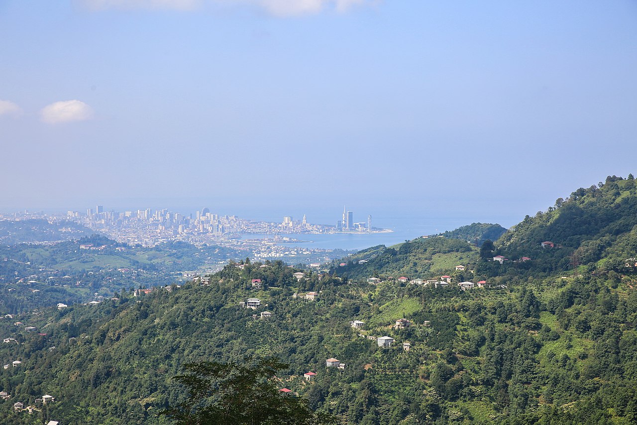
- In the south of the national park, the visitor can see many other sights such as exploring Batumi Canyon, finishing at Batumi Canyon Waterfall. It's possible to go up to Mount Mtirala (1334 m high), from where having great views of the national park, the cityscape of Batumi and the seaside. Its name means weeping mountain because this place is often cloudy, with fog and drizzle.
- In the north of the park there are also some mountains like, for example, Gora Dagva (1193 m high) and the cliff Skala Melis-Tsikhe (781 m high); or gorges such as Bezonistskali Gorge.
| One of the many waterfalls in Mtirala NP |
 |
| Views of Batumi from Mtirala National Park |


 07:47
07:47
 Banknotemaniac
 Posted in: